On this sheet
- Route walked
- Ground trail, unmapped
- Catch feature
Walking a Map Into the Field
A map that agrees with the ground everywhere gets no credit. Where it disagrees is where the reading actually happens.
A map that agrees with the ground at every step earns no attention at all, because agreement is the outcome you expected before you left the trailhead. The moment worth stopping for is the one where the paper says one thing and your legs, your eyes, or your compass report another. That gap is not a defect in the sheet, and it is rarely proof you have gone wrong. It is the map telling you something about itself — its survey date, its scale, the threshold below which its cartographer decided a feature wasn't worth the ink — if you know how to read the disagreement instead of just noticing it and pushing on regardless.
Orient the sheet before the first step, not the first doubt
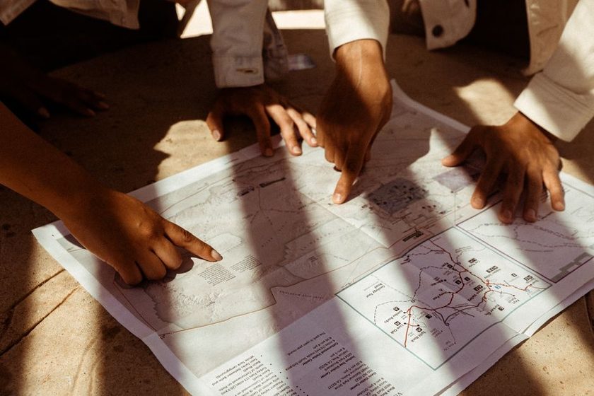
Most reconciling problems start before anyone has walked anywhere, in the handful of seconds when the map gets folded open and set roughly in the direction of travel. A compass needle alone will get the sheet pointing north, but it will not confirm that the feature under your boot is the feature you think it is on the page. The stronger habit is to find two features you can positively identify on the ground — a bend in a stream, a saddle between two rises, a junction — and rotate the map until the line between them on paper matches the line between them in front of you. That single act of triangulation does more to prevent an afternoon of confusion than any amount of staring at the sheet indoors. It also forces an early check on declination, since a bearing read straight off the map without correcting for it will drift steadily off from what a compass reads against true or magnetic north the longer a leg runs.
Where the ground disagrees with the paper first
The earliest mismatches tend to be small and easy to dismiss. A footpath underfoot that the sheet doesn't show at all. A rise that the contour spacing suggested would be a short, steep pull, but that the legs report as a gentle, unremarkable grade. A stand of trees standing where the map shows open ground, or the reverse. None of these individually means the map is wrong, and none of them means you are lost. Each one is a data point about the relationship between what a survey recorded and what exists now, and the useful move is to log it mentally and keep walking rather than stopping to relitigate your position over a single unmapped path.
Reading the disagreement instead of doubting it
Once a mismatch shows up, the question worth asking isn't "did I make a mistake," it's "what property of this map would produce exactly this gap." A missing footpath usually means it fell below the map's minimum feature size at whatever scale the sheet was printed, the same generalization decision that governs what smaller features survive onto a map and what gets quietly dropped as the scale shrinks. A climb that reads steeper on paper than it feels underfoot usually means the contour interval is coarse enough to average small rises and dips into a single band. A structure that's simply gone usually means real change happened between the survey date printed in the sheet's margin and today, and the honest response is to check that date before assuming your own position is the thing that's wrong.
A map that matches the ground at every step has usually just been walked by someone incurious enough not to notice where it didn't.Field note, Sheet 44
A short routine for staying reconciled on the move
Reconciling a map to terrain works best as a small set of habits repeated continuously, not a single check performed once at the trailhead:
- Orient the sheet using two features you can positively identify, not the compass needle alone.
- Keep a mental thumb on your last confirmed position, and move it forward only when a new feature confirms the next one.
- Pick a handrail — a stream, ridge, or treeline running roughly your direction of travel — and follow it instead of trusting a bearing in isolation.
- Set a catch feature past your target, something unmistakable, so that overshooting still tells you where you are.
- Stop and reconcile at every major decision point, not only once something already feels wrong.
Each of these habits is doing the same underlying job: turning a single point-in-time comparison into a running one, so that a small disagreement gets caught early, while it's still one contour line or one footpath, rather than after it has compounded across an entire unplanned leg.
Common disagreements and what they usually mean
| What you notice | Likely cause | What to do |
|---|---|---|
| A footpath underfoot isn't drawn anywhere on the sheet | Worn in since the last survey, or too minor to clear the map's minimum feature size at this scale | Note it and keep walking; confirm position against a feature that is on the map |
| Contour spacing reads like a short, steep pull; the climb feels gradual | The printed interval is coarse relative to the terrain's actual relief | Read the stated interval value in the legend, not the visual gap between lines |
| A compass bearing drifts a few degrees off the plotted line | Bearing taken from grid north without correcting for magnetic declination | Apply the declination figure printed in the sheet's margin before comparing bearings |
| Paced distance to a known feature comes up short or long | Pace count wasn't recalibrated for today's load, slope, or ground cover | Re-walk a known baseline under current conditions and adjust the count |
| A building, wall, or fence line on the map is simply gone | Legitimate change on the ground since the survey date | Check the sheet's revision date before assuming your position is wrong |
When the map is right and you are the variable
It's worth saying plainly that a printed sheet is often more stable than the instruments doing the comparing. Pace counts drift with fatigue and load. Slope feels gentler on the way down than the same grade felt on the way up an hour earlier. A bearing read in low light or while distracted carries more error than one read carefully at a stop. Before concluding that a map has aged out or gotten something wrong, it's worth ruling out the simpler explanation: that the walker, not the sheet, is the less consistent instrument on that particular afternoon. Recalibrating your own pace count and rereading a bearing costs a minute; second-guessing an accurate map costs the rest of the day.
- Reading Contour Lines Like a Story — how spacing and closure narrate slope and shape before you ever leave the trailhead.
- Grid North Versus True North — the correction a compass bearing needs before it can be trusted against a printed line.
- The Datum Problem Nobody Mentions — a quieter layer of disagreement that lives beneath the survey itself.